


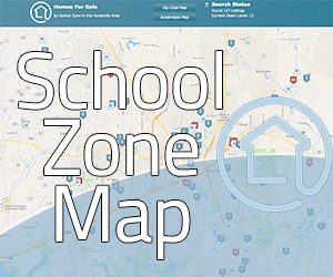
Valley Mls Hotspot Map
The Huntsville Area Association of Realtors® recently modified the search parameters often used by the general public when searching properties for sale on ValleyMls.com.
To facilitate an introduction of the new areas and simplify some search options we have provided the following hot-spot map and one click searches each with a description of the new area boundaries for a nice one click search page perfect for bookmarks.
Hover and Click Map for Instant Home Listings

Valley Mls One Click Searches
A textual boundary description of each ValleyMls area and one click searches.
Madison County NW: North boundary is the Tennessee State Line; West boundary is HWY 53; East boundary is HWY 231/431, South boundary is Bob Wade Lane/Research Park BLVD.
Madison County NE: North boundary is the Tennessee State Line; West boundary HWY 431/231; East boundary is Winchester Road, South boundary is Countess Road/Moores Mill Road.
New Market/Riverton: North boundary is the Tennessee State Line; West boundary is Winchester Road/MooresMill Road; East boundary is Jackson County Line; South boundary is Hwy 72 E.
Harvest/Monrovia: North boundary is HWY 53; West boundary is County Line Road; East boundary is Research Park BLVD; and South boundary is HWY 72.
Huntsville North: North boundary is Bob Wade Lane/Countess Road; West boundary is Research Park BLVD; East boundary Countess Road and MooresMill Road; South boundary HWY 72/I 565.
Madison City: Boundaries for this area will be the city limits of Madison until further notice.
Research Park Area: North boundary is HWY 72; West boundary is Slaughter Road, East boundary is HWY 53/Jordan Lane; South boundary is Alt HWY 72/I 565.
Huntsville East: North boundary is HWY 72/I 565; West boundary is HWY 231/431 (Memorial PKWY); East boundary is Monte Sano Mountain Ridge; South boundary is HWY 431 S.
Wheeler Area: North boundary is HWY 72/I 565; West boundary is County Line Road, East boundary is Zierdt Road/Redstone Arsenal Boundary; South boundary is Morgan County line.
Mill District: North boundary is Alt HWY 72/I 565; West boundary is Bob Wallace Avenue/Patton Road/Redstone Arsenal boundary line. East boundary is HWY 231 and South boundary is Martin Road.
Huntsville South: North boundary is HWY 431 S; West boundary is HWY 231 (Memorial PKWY), Martin Road and Redstone Arsenal boundary line. East boundary is Monte Sano and Green Mountain Ridges; South boundary is Morgan and Marshall County Lines.
Mountain Cove: North boundary is HWY 72; West boundary is Monte Sano and Green Mountain Ridges; East boundary is Jackson County Line; South boundary is Cave Spring Road/Cherry Tree Road.
New Hope/Owens Cross Roads: North boundary is Cave Spring Road/Cherry Tree Road; West boundary is Oak Grove Road/Clark Hollow Road/Rock Spring Road; East boundary is Marshall County line and a small portion of Jackson County line; South Boundary is Marshall County line.


Comments on this entry are closed.